• More Girls To Parks ! Case Study of Einsiedler Park, Vienna, Milota Sidorova

    Compared to boys, girls in the age of 9-12 years don‘t spend as much time in parks and on playgrounds. And while you may have the memory of boys actively playing football all around, girls are really missing. Girls like to chat and spend the time indoors, some explain. Well, you don‘t feel that quite a sufficient explanation even you, yourself not being a gender studies expert.

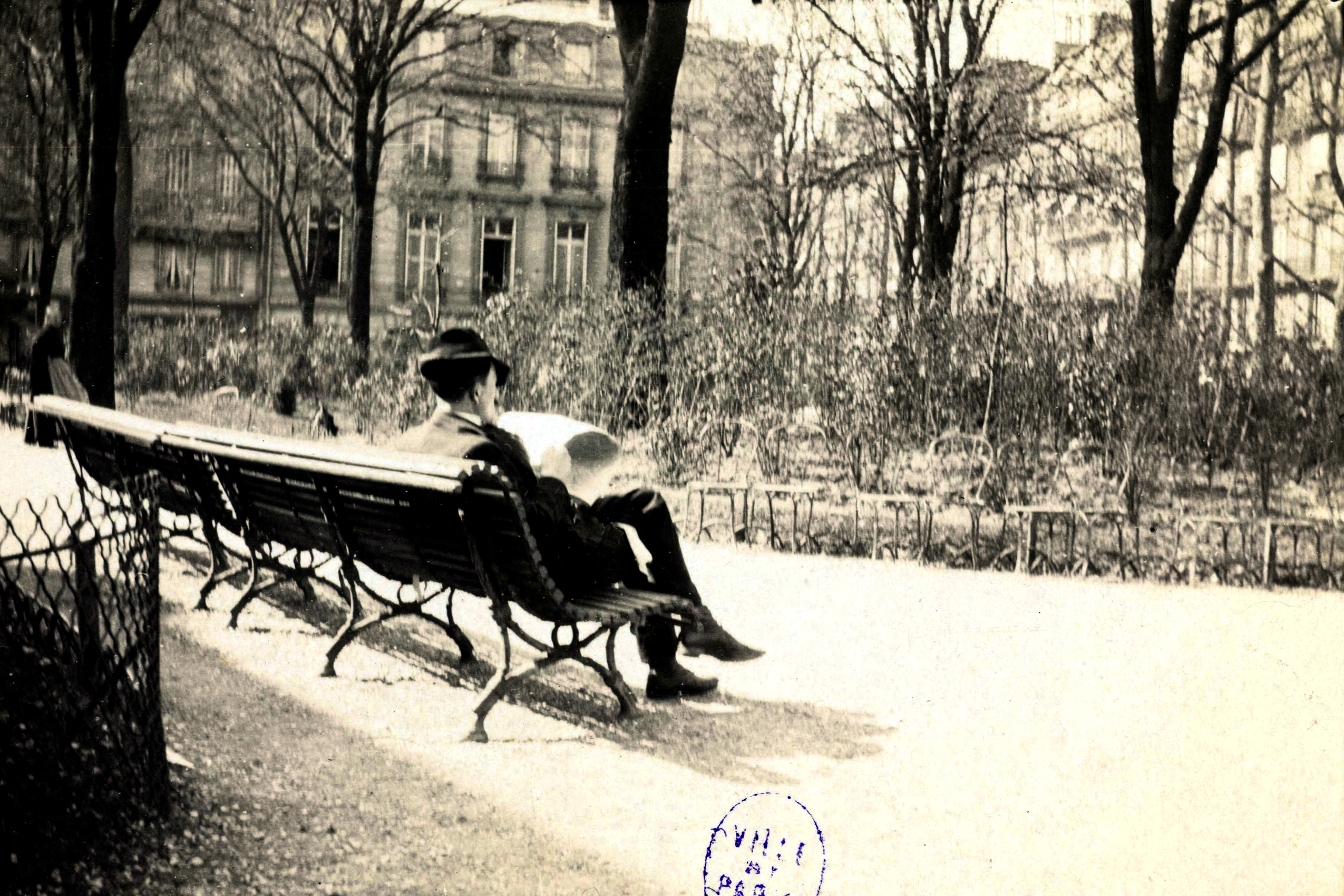
    Girls pass through Einsiedler park twice a way. Before and after school. They cross the paths through the park and quickly disappear. The park is located in ethnically diverse Viennese district. The other group of girls we have noticed were girls from families of ethnic background. They come and look up for their younger siblings, this is quite typical situation, explains Claudia Prinz-Brandenburg, landscape architect working for Park Department of Vienna.

    The pilot study consisted of several rounds of workshops with girls within one year‘s time. The results were quite surprising and showed there were no facilities for them, girls had no reason to stop here. So an inventory of the park came. Fenced, encaged basketball playground, benches, greenery and relatively poor lighting. Since there was nothing that would serve young girls, Viennese chose the strategy of quick attraction. Different elements like platforms, interactive game installations, hammocks were placed along main pedestrian roads. These elements grabbed attention of passing kids, girls among them. They stopped them for couple of more minutes. And if they are passing walking and talking and have to spend the time outdoors, why not in the park?

    Fear, which is a feeling hard to define by hard data was one of the results of workshops with the girls. They mentioned fear of probable danger. Widening main pedestrian roads leading through the park, improving lighting conditions – these were the first steps. The central element of the park is the enclosed cage playground which we call ballcage among ourselves.

    We enter the playground. After Claudia draws out the idea of fear, for a moment I see myself being eleven years old starting teenager who would be flirting with boys while playing footbal. I could see standing groups of older boys that I dared not to look at. I could see the only door into the cage and them standing very close, controlling walk-ins and walk-outs. And their comments! Oh! The intensity of a sudden memory suprised me even as a thirty years old woman. It is the the fear from impossibility to exit the enclosed space full of strangers, this is the fear that prevents girls from entering playgrounds. To prevent that a redesign ofpark was prepared by the Park Department of Vienna in cooperation with the Coordination Office for Special Needs of Women. The fence was open from three sides and double layered at sites offering three large ways to exit the playground for safe street. Suddenly you feel it and you can breathe.

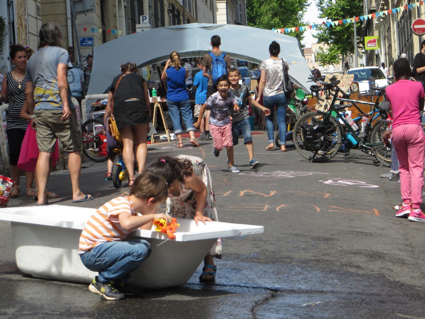
    Young girls like to watch the game of the others, for example – boys. It takes a little while before they start to play themselves, they like to chat among themselves. Also you can rarely see a girl coming to the playground alone, usually they come in two or in little groups. Only when they feel confident enough they go and play. The playground space is split into two by low platform that was designed for sitting and observing. After a while it became a real center where girls started to play the music, dance and all kinds of informal, spontaneous activities emerged, says Claudia. Finally we had girls in the park!

    Gender mainstreaming carefully analyzes behavior and needs of girls, reorganizes space and improves its usability. It doesn’t necessarily improve aesthetics, but focus on optimizing functions.

    In Einsiedler park we see two playgrounds out of which one is designed for basketball and football. The other one has no signs, no equipment, nothing. With its zero design it is the space for informal ball games. Had we designed the playground, we would immediately formalize another space for football and basketball, games usually performed by boys. Girls tend to play games using whole body, including singing or chatting, throwing ball.

    The effect is that boys and men usually occupy one side of the playground, while the other is used by girls and mixed groups.

    Einsiedler park serves as a central living room of the district. Since the flats are really small here, people tend to spend quite a lot of time outdoors. To be outdoors is partially a culture, partially a necessity, especially for people of ethnic background and low income. So are sisters taking care of their younger siblings on typical playground for the youngest. Here, however they have no place to talk or play themselves. Park Department designed another playground, game elements just next to the place where their siblings are. They also placed tables and benches into the playground for kids below 6 years of age, so their baby sitters can sit inside while having their own space. Two groups of different needs were combined in one space while keeping open-ended options for both of them.

    I am passing through the park that looks nothing special at the first sight. Neither elements, nor materials look any special, hyped by design or another novelty. Still I find myself quite amazed by this behavioral explanation. Gender mainstreaming carefully analyzes behavior and needs of girls, reorganizes space and improves its usability. It doesn’t necessarily improve aesthetics, but focus on optimizing functions.

    Did you achieve what you set out to do?

    Oh yes, after a year we did an evaluation study and found out that the number of girls present in parks increased. So did the amount of informal activities. Results of this pilot project were summarized into guiding principles adopted by Park Department which have been used in design of any new park since then, sums up her part of the walk Claudia Prinz Brandenburg.

    Achieving the knowledge is a thing of expert nature, to pass on the changes – unfortunately – is something quite different.

    For me everything started when I gave birth to my twins. I had to push a giant double stroller over sidewalks of Vienna. Surely you can imagine how terrible that was – cars, narrow, uneven sidewalks, dark corners when one does not see. I immediately realized that life in city does not give the fair chances to women, especially mothers, says Renate Kaufman, sharp woman of grey eyes that directly find their target. Former teacher got incredible sensitivity towards needs of children and parents. Later on she joined politics and two years ago she concluded her fourteen years long mission on as a Chairwoman of 6th Viennese District that became the pilot district of gender mainstreaming implementation.

    Fourteen years, that is quite a time! I say to myself, I – the citizen of Central European space used to four years long political cycles that bring complete opposition towards urban planning policies of the former establishment. Political discontinuity is not efficient, but rather destructive and in its best it is – tiring. Human life however flows continually, from day to day, from year to year, slowly turning decades. It is full of duties and roles that are happening in a physical space of the city. Back home, politics is perceived as a game of sharks, dominant types discouraging more compassionate types from entering it. And when we think of our urban planning it is still considered rather a technical discipline. Parametric control over indicators of traffic, quotas on areas that are be built or not to built, volumes, heights, areas designed as development areas, all of this gives us false feeling that we are planning our cities rationally, ergo, good. But where in all of this we can find true understanding of everyday human life? Try to go even further and bring the term gender equality into this hard professional environment.

    Some municipalities tuned onto words like participation and sustainable development. We are still, however only starting. Reality of participation turns into overuse of surveys, but not a real understanding of groups representing wide range of users. We are still witnessing unprofessional processes which on the top of that are not properly paid. Awareness however kicks in and urban planners and some municipal representatives start to speak about manuals of public spaces.

    How to design good public space? For whom?

    For people.

    What kind of people?

    Well, here is where I usually don’t get the answer much further. But this is the space, the opener where you can really start to get interested in the layer of gender and gender equality. Gender mainstreaming (balancing opportunities for men and women) was implemented in Vienna in 90ties under the directive of European Union. Here is also where I stop using the passive voice. Gender mainstreaming grew into urban planning by pragmatic and practical work of Eva Kail, urban planner who had her own aha moment in 1991. She organized the exhibition Who Owns the Public Space and became interested in connections among old woman, mother, woman of ethnic background, girl using the city. She studied methodologies of gender mainstreaming in architecture and urban planning being already a norm in Germany. Later on, being an employee of Urban Planning Department of the City of Vienna, she started to lobby for budgets. Budgets for pilot studies of user behaviors, budgets for pilot projects – just like the one in Einsiedler park. During her career she was able to assist in more than 60 pilot projects, covering practical aspects of gender mainstreaming and gender equality in housing, transportation, planning and design of small scale public spaces, just like the ones of large scale.

    If you want to do something for women, do something for pedestrians.

    Results showed us women walk and use public transport more than men. Men are more frequent car drivers. Why? Well, this is connected to life roles and duties. If a woman is a mother or care taker, her way through the city is more complex. Men take cars and go to work and back. Usual. This pattern has not changed even in 2016. So, if you want to do something for women, do something for pedestrians, says Kail.

    If women are the major client in public space, how it should function? Try to look at it through eyes of mothers, girls or elderly women. The differences will come out of quite simple observation. The rest is a question of common sense and measures taken.

    How did you achieve all of this in your neighborhood? I ask Renate Kaufmann, who energetically lead our group through the streets and explain why the sidewalks are lower here, why the light was placed there or why the mirror, at all. She is much more persuasive than the gender expert herself. In politics I love to fight for the right causes, she looks at me and for a long time I have nothing to say...

    http://www.wpsprague.com/research-1/2017/1/6/more-girls-to-parks-case-study-of-einsiedler-park-viennamilota-sidorova

    #genre #femmes #espace_public #géographie #Vienne #parcs #parcs_publics #filles #garçons #enfants #enfance #villes #Autriche #urban_matter

    ping @nepthys

  • #Gated_communities, le paradis entre quatre murs

    Sécurité, entre-soi, rêve de vacances perpétuelles. À l’heure où un supposé « sécessionnisme » envahit le débat public, quoi de mieux que d’évoquer les « gated communities », principal avatar des stratégies d’auto-enfermement gagnant le monde ?

    Comme le souligne l’excellent documentaire Bunker Cities, « le XXIe siècle sera celui des murs ». Murs entre pays bien sûr, mais également murs internes, notamment matérialisés par les fameuses gated communities, des communautés fermées plus ou moins coupées du reste de la ville et/ou de la société. Ce type d’habitat a le vent en poupe et contribue à détruire un des fondamentaux d’une société : la diversité. Raison qui rend la compréhension de ce phénomène indispensable.

    Ces quartiers privés, d’abord populaires dans des mégapoles très inégalitaires (Los Angeles, Rio de Janeiro, Johannesburg, etc.), se propagent peu à peu sur les cinq continents. Ils sont la plupart du temps facilement repérables puisque entourés de clôtures ou de murs et ne sont accessibles que via des points d’entrée plus ou moins surveillés selon l’environnement socio-économique (porte à digicode, caméras, vigiles, herses anti-intrusion). Leur présence peut cependant passer plus inaperçue, notamment dans les centres villes verticaux, où cette privatisation de l’espace se manifeste sous l’apparence d’un simple gratte-ciel mais dans lequel toute une série de services ne sont disponibles qu’aux habitants, encourageant ces derniers à minimiser tout contact avec la vie extérieure. Mais qu’est-ce qui rend si attractif ce genre d’habitat ? Et quelles sont les conséquences de ces quartiers fermés.
    Sécessionnisme sécuritaire

    Très souvent, l’argument phare est de procurer aux habitants un sentiment de sécurité qu’ils ne retrouveraient pas ailleurs. L’insécurité contre laquelle l’objectif est censé protéger peut être, selon les cas, réelle ou fantasmée. Il est clair que dans de nombreuses villes au sein desquelles les disparités sont fortes, les tensions sociales sont extrêmes et peuvent se traduire par des atteintes aux biens et aux personnes, en particulier les plus aisées. Ainsi, au Brésil ou en Afrique du Sud, les enlèvements suivis de rançons sont fréquents et contraignent de nombreux citoyens à vivre au sein de dispositifs de surveillance quasi militaires pour retrouver au moins un semblant de sérénité. La clôture traduit ainsi l’obsession de nombreux quartiers aisés à se retrancher et à dissimuler leurs richesses et leur style de vie[1].

    Si les risques sont évidemment moins élevés dans des villes plus petites et/ou moins inégalitaires, on remarque tout de même que cet argument sécuritaire fait bien toujours partie des motivations des habitants. Ce qui nous amène à bien distinguer la sécurité du sentiment de sécurité. Les gated communities se chargent le plus souvent de répondre davantage à ce dernier qu’à la sécurité en tant que telle. Il suffit de voir la faiblesse de nombreux dispositifs de surveillance quant à une hypothétique attaque de gens extérieurs. De l’aveu même de nombreux habitants, ces dispositifs visent ainsi à rassurer plus qu’à protéger. Il n’empêche qu’ils constituent pour beaucoup une échappatoire vis-à-vis du quotidien anxiogène très présent à l’ère des grands médias en concurrence et de réseaux sociaux toujours plus avides de sensationnalisme.

    À noter que cet argument sécuritaire revient également pour ce qui concerne la petite enfance. Vivre entre quatre murs permettrait ainsi une certaine insouciance quant aux risques d’accidents de la route et/ou de mauvaises rencontres que risquerait notre progéniture.
    Un entre-soi clôturé

    Autre argument souvent mis en évidence à la fois chez les promoteurs et chez les habitants des gated communities : une certaine homogénéisation sociale, voire ethnique, qu’autorise cette forme particulière de vivre-ensemble. Ces quartiers permettent en effet une vie entourée de ses semblables, souvent ni trop pauvres, ni trop différents culturellement, ce qui faciliterait un quotidien routinier très ordonné et de nouveau sans mauvaise surprise. La plupart des quartiers de ce type sont d’ailleurs très peu habités par des minorités, exception notable des pays du Sud où de nombreux expatriés en ont fait leur lieu de prédilection.

    Mais ne nous leurrons pas. Pour l’immense majorité des habitants, l’homogénéité dont il est question est avant tout socio-économique. En d’autres termes, importent moins la culture et la couleur de peau qu’un certain standing, sinon en termes de niveau de revenus, du moins en termes de mode de vie. Il faut d’ailleurs souligner que, contrairement à une idée reçue, les résidences fermées ne sont pas toujours des ghettos de riches. Dans de nombreux endroits, ce type d’habitat a tendance à se démocratiser et attire également une classe moyenne en perte de repères. Ce phénomène est particulièrement visible aux États-Unis, probablement car il permet la combinaison d’un mode de vie dans lequel l’esprit de communauté a une grande importance avec un fort individualisme, notamment résidentiel.

    Cette homogénéisation peut dans certains cas prendre des allures caricaturales, à l’instar de la célèbre ville privée de Sun City, en Arizona (près de quarante mille résidents), exclusivement réservée aux retraités et dans laquelle le règlement n’a d’autre but que de faire profiter les habitants d’une certaine quiétude bien méritée après une vie de dur labeur. Règlement qui va jusqu’à fixer les heures de visites des petits enfants pour ne pas déranger le voisinage. Car pour bénéficier de cette quiétude, un des prix à payer est de se plier à un ensemble de règles strictes en vigueur dans toute gated community qui se respecte : absence de nuisances, calme, entretien de son environnement, contrôle de la venue de populations extérieures, etc. Tout un règlement visant à ne pas venir troubler la tranquillité du voisinage et garantir le fameux standing à ce qui reste, ne l’oublions pas, un produit commercial immobilier.

    À noter que d’autres gated communities basent leur existence sur l’orientation sexuelle (« villages gays » réservés aux populations homosexuelles en Floride ou en Californie) ou le caractère ethnique (quartiers privés réservés à une certaine couleur de peau).
    En vacances toute l’année

    Très souvent, le concept de gated community inclut également une panoplie de loisirs parfois dignes des meilleurs clubs de vacances qui foisonnent dans les régions ensoleillées. Piscine, golf, centre commercial, église, cours particuliers de sport, livraison de nourriture à domicile, animations musicales, bars et restaurants. Bref : tous les ingrédients pour constituer une réplique de ce que l’on peut trouver à l’extérieur mais dans un entre soi contrôlé. Le tout donnant l’impression aux habitants de vivre « en vacances toute l’année ». Cet aspect paradisiaque se ressent jusqu’aux mots composant l’appellation de nombreuses gated communities tels que palm, sun, falls, garden, resort, lake, wood, etc.

    À cet égard, on peut faire un parallèle avec les complexes hôteliers présents aux quatre coins du monde et qui vont jusqu’à former de véritables enclaves touristiques également déconnectées de l’arrière-pays et de ses réalités locales. Il est d’ailleurs significatif que nous retrouvons dans l’argumentaire marketing de ce type de tourisme les mêmes types d’« avantages » qu’offre le mur pour les gated communities : sentiment de sécurité, absence de mendicité et de rencontres indésirables, homogénéité culturelle (un comble dans un pays étranger…).
    Une nature artificielle

    Dernière motivation et non des moindres : la volonté de vivre dans un cadre agréable et un environnement préservé. Concrètement, cela implique une faible circulation automobile, des espaces verts, du calme et, quand le pays le permet, un climat agréable toute l’année. Et tant pis si cet environnement naturel est en réalité… tout à fait artificiel : fontaines ostentatoires, pelouses parfaitement tondues et bien vertes, même dans des zones arides, arbustes taillés à la perfection, parterres fleuris et colorés, étangs, cascades[2]. Tout est réuni pour fournir un idéal paysager, rassemblant d’ailleurs souvent davantage à un décor de parc à thèmes qu’à un vrai paysage. Que l’on se trouve à Karachi, au Caire ou à Mexico, un trait caractéristique de nombreuses gated communities est leur côté interchangeable et identique, ce qui peut sans problème les faire rentrer dans la catégorie de « non-lieux », à savoir des espaces standardisés et déshumanisés dépourvus de toute histoire sociale et collective.

    Bien souvent, cet intérieur très propret contraste avec l’extérieur des murs, en particulier dans les pays du Sud, où l’espace public est abandonné par un pouvoir défaillant et dépourvu de moyens. Ce type de quartier accentue ainsi la déconnexion des habitants avec le reste de la société (d’autant plus quand une partie significative des classes dirigeantes vit précisément du côté propre et sécurisé de la barrière).
    Des conséquences au-delà du mur

    Questionner le concept même de gated community vise à analyser ses impacts, notamment car ceux-ci se font sentir au-delà du quartier concerné. Cette logique d’emmurement volontaire est plus perverse qu’elle n’en a l’air car elle contribue, comme l’explique Stéphane Degoutin, à une « bipolarisation de la ville, dans laquelle tout est organisé pour qu’il n’existe aucune communication entre les « bons » et les « mauvais » quartiers »[3]. Pire encore, elle encourage chez les résidents le sentiment que « peu importe que le contexte se détériore tant qu’il est derrière les murs ». En ignorant son environnement, on contribue ainsi à sa dégradation. En d’autres termes, « y habiter, c’est renoncer à résoudre le problème de la société »[4].

    Cette homogénéisation choisie favorise ainsi une homogénéisation subie, celle des quartiers défavorisés, lesquels connaissent un désinvestissement croissant (transports et services publics, mobilier urbain, éducation) du fait de l’exode des ménages les plus fortunés, phénomène réduisant l’assiette fiscale du territoire. Comme l’explique Loïc Wacquant, c’est la première partie d’un cercle vicieux rendant ces quartiers encore plus propices à la misère et à la violence[5], renforçant leur mauvaise réputation et les stéréotypes sur leurs habitants.

    Cette gestion de l’espace à deux vitesses atteint son paroxysme dans des zones de guerres, à l’instar de l’Irak où des quartiers ultra sécurisés sont instaurés pour les fonctionnaires américains liés à l’occupation militaire du pays. Ces « zones vertes », raconte Naomi Klein, « ont leur réseau électrique, leur réseau téléphonique, leur réseau d’égouts, leur réserve de pétrole et leur hôpital de pointe équipé de salles d’opérations immaculées, le tout protégé par des murailles de cinq mètres d’épaisseur, tout cela au milieu d’une mer de violence et de désespoir »[6].

    Cette allégorie insulaire résume le succès des gated communities, jamais très loin de l’idéal paradisiaque qui gouverne nos imaginaires, nourris des mythologies religieuses dans lesquelles, rappelle Marie Redon, nous retrouvons souvent « la notion d’enclos et de jardin d’agrément, d’un espace limité et réservé à quelques heureux élus méritants »[7].

    [1] Davis Mike, City of Quartz. Los Angeles, capitale du futur, Paris, La Découverte, 1997, p222.

    [2] Paquot Thierry (sous la direction de), Ghettos de riches, Paris, Perrin, 2009, p160.

    [3] Degoutin Stéphane, Prisonniers volontaires du rêve américain, Paris, Éditions de la Vilette, 2006, p263.

    [4] Ibid, p161.

    [5] Wacquant Loïc, Parias urbains – Ghettos, banlieues État, Paris, La Découverte, 2006, p169.

    [6] Klein Naomi, La Stratégie du choc – La montée d’un capitalisme du désastre, Paris, Actes Sud, 2008, p638.

    [7] Redon Marie, Géopolitique des îles, Paris, Le Cavalier Bleu, 2019, p82.

    http://geographiesenmouvement.blogs.liberation.fr/2020/10/21/gated-communities-le-paradis-entre-quatre-murs
    #murs_intra-urbains #villes #urban_matter #géographie_urbaine #barrières #frontières

    • Studying Diversity, Migration and Urban Multiculture. Convivial Tools for Research and Practice

      Anti-migrant populism is on the rise across Europe, and diversity and multiculturalism are increasingly presented as threats to social cohesion. Yet diversity is also a mundane social reality in urban neighbourhoods. With this in mind, Studying Diversity, Migration and Urban Multiculture explores how we can live together with and in difference. What is needed for conviviality to emerge and what role can research play? This volume demonstrates how collaboration between scholars, civil society and practitioners can help to answer these questions.

      Drawing on a range of innovative and participatory methods, each chapter examines conviviality in different cities across the UK. The contributors ask how the research process itself can be made more convivial, and show how power relations between researchers, those researched, and research users can be reconfigured – in the process producing much needed new knowledge and understanding about urban diversity, multiculturalism and conviviality. Examples include embroidery workshops with diverse faith communities, arts work with child language brokers in schools, and life story and walking methods with refugees.

      Studying Diversity, Migration and Urban Multiculture is interdisciplinary in scope and includes contributions from sociologists, anthropologists and social psychologists, as well as chapters by practitioners and activists. It provides fresh perspectives on methodological debates in qualitative social research, and will be of interest to scholars, students, practitioners, activists, and policymakers who work on migration, urban diversity, conviviality and conflict, and integration and cohesion.

      https://www.uclpress.co.uk/products/117058
      #multiculturalisme #villes #urban_matter #conflit #convivialité #intégration #cohésion #livre

  • En France, neuf personnes sur dix vivent dans l’aire d’attraction d’une ville - Insee Focus - 211

    https://www.insee.fr/fr/statistiques/4806694

    En France, neuf personnes sur dix vivent dans l’aire d’attraction d’une ville

    Marie-Pierre de Bellefon, Pascal Eusebio, Jocelyn Forest, Olivier Pégaz-Blanc, Raymond Warnod (Insee)

    L’aire d’attraction d’une ville définit l’étendue de son influence sur les communes environnantes. En France, les 699 aires d’attraction des villes regroupent plus de neuf personnes sur dix : 51 % de la population française habite dans les pôles et 43 % dans les couronnes. Une personne sur cinq vit dans l’aire d’attraction de Paris.

    Entre 2007 et 2017, la population augmente nettement dans les aires d’attraction de 700 000 habitants ou plus. Depuis 2012, la population est stable dans les aires de moins de 50 000 habitants et dans les communes hors attraction des villes. Au sein des aires, la croissance de la population est plus faible dans les communes-centres que dans les couronnes.

    #france #urban_matter #aires_attraction #géographie #Cartographie #centralité #périphérie #bide #plein

  • Urbanisme entrepreneurial « durable » au Maroc : Quel(s) changement(s) pour les #villes_minières ?

    Il est impressionnant d’observer la place de plus en plus prépondérante, pour ne pas dire démesurée, qu’occupent désormais les notions de durabilité et de développement durable sur la scène politique et médiatique ainsi que dans le processus d’élaboration des différentes politiques publiques au Maroc (Philifert, 2015). Certes, l’intérêt pour ces notions remonte au début des années 1990, lorsque le Maroc a affiché son engagement pour les objectifs de développement durable au Sommet de Rio. Or, avec l’arrivée du nouveau monarque au début des années 2000, cet intérêt a pris un tournant considérable dans le cadre d’une politique néolibérale tournée vers l’international (Catusse, 2011). Stratégie nationale de développement durable, Initiative nationale de développement humain, Charte nationale pour la protection de l’environnement et le développement durable, Plan Maroc Vert, etc., autant d’initiatives mises en place depuis lors afin de véhiculer une nouvelle image du royaume en tant que pays « modèle » en matière de développement durable (Barthel et Zaki, 2011). Cette ambition s’est illustrée très récemment par l’organisation de la Conférence mondiale sur les changements climatiques (Cop 22) à Marrakech, au cours de laquelle le Maroc s’est engagé à établir un ensemble de mesures juridiques et constitutionnelles pour l’environnement[1]. Au-delà des multiples mesures adoptées, le pays a également mis en œuvre plusieurs projets de grande envergure dits durables à vocation industrielle, touristique, énergétique et urbaine qui s’inscrivent dans la circulation internationale croissante des modèles d’urbanisme durables (Ward et McCann, 2011).

    http://www.jssj.org/article/urbanisme-entrepreneurial-durable-au-maroc-quels-changements-pour-les-villes-m
    #Maroc #extractivisme #villes #urban_matter #géographie_urbaine #urbanisme

    ping @reka

  • Si l’échec est un but, la transition écologique du BTP pourrait être un chef-d’œuvre - D’architectures

    https://www.darchitectures.com/si-echec-est-un-but-la-transition-ecologique-du-btp-pourrait-etre-un

    Des conflits d’intérêts,

    Une « task force »,

    Un rapport secret,

    Une mise en œuvre de plus en plus cryptique,

    Et la certitude de dépenser 7 milliards au profit d’une industrie qui continue d’évoluer dans la plus grande impunité environnementale…
    La rénovation énergétique du bâtiment s’inscrit-elle encore dans la stratégie nationale bas-carbone ?

    En mai dernier, notre gouvernement a confié la coordination d’une « task force » pour la rénovation énergétique du bâtiment à Pierre-André de Chalendar, PDG de Saint-Gobain, leader mondial en matériaux d’isolation. Les 20 propositions transmises à l’exécutif en juillet 2020 par ce commando d’industriels (Total, Schneider Electric, ENGIE) n’ont pas encore été rendues publiques.

    Consulter une entreprise du CAC 40 pour définir un volet de la stratégie publique de neutralité carbone n’étonne plus personne. Le conflit d’intérêts fait partie de l’ADN du bâtiment. Un tel mécanisme dans le domaine de la santé publique ferait trembler les bases de notre État de droit mais dans la filière du BTP, il faut bien le reconnaître, l’intervention d’intérêts privés dans l’écosystème de l’action publique est la norme.

    Pour s’en convaincre, une lecture rapide de l’organigramme des institutions parmi les plus influentes de la filière industrielle du BTP suffit. À la tête du Centre scientifique et technique du bâtiment (CSTB), organisation publique chargée de définir les normes de construction ? Hervé Charrue, ex-salarié de Saint-Gobain et membre de différents comités directeurs du groupe coté en Bourse. À la présidence de l’association Alliance HQE-GBC France, principal certificateur « environnemental » du bâtiment (plus de 100 000 certifications NF de logements en 2017) ? Philippe Van de Maele, homme d’affaires et ex-analyste financier du groupe Saint-Gobain…

    Rien d’étonnant donc, à ce qu’Emmanuelle Wargon, alors secrétaire d’État auprès de la ministre de la Transition écologique et ex-lobbyste du groupe Danone chargée des questions environnementales auprès des pouvoirs publics, ait parrainé un tel mariage. Dans le BTP, la confusion des intérêts publics et industriels semble avoir toujours servi une certaine conception de la mission de l’État visant l’efficacité économique au détriment, parfois, de l’utilité sociale et de la morale politique.

    #architecture #Logement #habitat #urban_matter

  • #Athènes : un regard critique sur les #trottinettes_électriques

    Les trottinettes électriques ont fait récemment leur apparition à Athènes, accompagnées comme dans d’autres villes grecques d’un discours approbateur de la part des journalistes et des collectivités locales (Αθηναϊκό-Μακεδονικό Πρακτορείο Ειδήσεων/ Agence Nouvelles d’ Athènes-macédonienne , 2019 / Journal Η Εφημερίδα των Συντακτών, 2019 / TyposThes, 2019) sur l’intégration dans le cadre urbain de cette nouvelle offre de mobilité verte et alternative [1]. Les informations qui traitent ce sujet ne permettent pas de structurer un discours public sur la ville, mais aboutissent à une réception acritique du modernisme occidental couplée à une indifférence envers l’organisation de l’espace public en ville. Ceci est le résultat d’une aphonie publique toute particulière concernant l’urbanisme, à laquelle contribuent depuis des décennies les autorités comme les athéniens, qui ont trouvé refuge dans les avantages que les uns comme les autres tirent de l’appropriation à petite ou grande échelle de l’espace public. A travers ce texte, nous tentons d’exercer une critique envers ce nouveau moyen de transport, avec la défense de l’espace public et de son usage collectif comme visée ultime.

    https://www.athenssocialatlas.gr/fr/article/athenes-un-regard-critique-sur-les-trottinettes-electriques
    #mobilité #urbanisme #Hive #géographie_urbaine #urban_matter #Grèce

  • Le quartier d’habitat social à #Tavros

    La zone étudiée est l’un des quartiers créés à Athènes (comme ceux de Dourgouti, Asyrmatos, Ambelokipi, etc.) afin de loger les réfugiés d’Asie Mineure de la décennie 1920. L’installation des réfugiés s’est faite soit par auto-installation dans des baraquements, soit de manière organisée dans des logements construits par l’État. Au cours des années qui ont suivi le quartier a reçu un grand nombre de migrants de l’intérieur, tandis que dès les années 1950 débute la construction progressive d’immeubles dédiés au relogement des réfugiés et ouvriers vivant dans les baraquements. Contrairement à d’autres zones d’habitation de réfugiés (comme par exemple Ilissos, Polygono, Kountouriotika), qui ont été rasés et dont les traces se sont perdues puisqu’elles se sont totalement fondues dans le tissu urbain environnant, Tavros est parvenu, à travers la création d’ensembles de logements sociaux, à conserver ses particularités vis-à-vis de son environnement large.


    https://www.athenssocialatlas.gr/fr/article/lhabitat-social-a-tavros
    #urbanisme #géographie_urbaine #Grèce #Athènes #habitat_social #cartographie #visualisation #réfugiés #histoire #quartiers_de_réfugiés

  • Atlas social et spatial du #Pirée des réfugiés

    Le programme de recherche interdisciplinaire de la Fondation Nationale de la Recherche et de l’Université polytechnique nationale d’Athènes « #Quartiers_de_réfugiés du Pirée – de l’émergence à la mise en valeur de la mémoire historique », dont l’objectif est d’étudier l’ensemble des #quartiers de réfugiés qui se sont développés dans l’agglomération piréote après 1922, s’est achevé il y a quelques mois. A cette occasion, nous en présenterons ici brièvement les constatations en matière sociale et urbanistique.

    L’installation urbaine des réfugiés dans l’agglomération du Pirée a constitué un processus graduel qui à ce jour n’a toujours pas fait l’objet d’une analyse détaillée. Ce programme de recherche a tenté d’analyser cette installation en exploitant des documents historiques, des archives non classées, des journaux d’époque mais également des témoignages oraux. D’autre part, un grand nombre de plans topographiques et de fragments de cartes ont été rassemblés par les différents services et structures investies dans cette étude, et qui, après numérisation et harmonisation, ont été positionnés sur un même fonds cartographique. Ceci a rendu possible une lecture et une compréhension plus approfondie de la géographie urbaine de l’installation des réfugiés.

    Tout ce que nous venons d’évoquer a permis d’élaborer une nouvelle narration de l’histoire de l’installation des réfugiés au Pirée, ainsi que de l’identification et de la mise en valeur de lieux d’un intérêt particulier d’un point de vue urbanistique et historique. Les éléments rassemblés suite à un plus ample traitement et à un examen approfondi du processus d’évolution résidentielle, serviront de base à la création de l’atlas des réfugiés de l’agglomération piréote.


    https://www.athenssocialatlas.gr/fr/article/atlas-social-et-spatial-du-piree-des-refugies
    #histoire #réfugiés #Athènes #Grèce #géographie_urbaine #urbanisme #mémoire #cartographie

  • #Koukaki à travers le regard de sept de ses habitants : Un lieu de résidence et de passage

    Koukaki s’étend de la rue Dionysiou Areopagitou à la place Koundourioti (« aire de jeux ») et de la lisière du mont Philopappos à l’avenue Syggrou (Carte 1). Il s’agit d’une zone chargée d’une longue histoire, et, au cours des décennies récentes, d’importantes mutations : la piétonisation de deux rues centrales, puis l’arrivée de deux stations de métro, l’ouverture du nouveau Musée de l’Acropole, et plus récemment, l’apparition du phénomène Airbnb et l’intensification des activités de loisir. Ces évolutions sont ici abordées à travers le regard de sept habitants du quartier, ayant chacun un parcours, une expérience et une perception différente du quartier et de ses transformations.


    https://www.athenssocialatlas.gr/fr/article/koukaki-un-lieu-de-residence-et-de-passage
    #Athènes #géographie_urbaine #urbanisme

  • « Lire la ville » de Chantal Deckmyn
    https://topophile.net/savoir/lire-la-ville-de-chantal-deckmyn

    Ce livre vient à son heure, alors que la question du vivre ensemble se pose avec acuité du fait des multiples fractionnements de la société française pour des raisons économiques, sociales, et politiques, aggravées par les inégalités existantes face à l’accès à un habitat décent pour tous qui en sont la conséquence. La ville, qu’on... Voir l’article

    • Lire la ville. Manuel pour une hospitalité de l’espace public

      Ce livre est un #manifeste pour la ville. Ce n’est ni un pamphlet ni une critique amère ou nostalgique de notre réalité. C’est un #manuel pratique qui s’adosse à une pensée et à une #éthique de la ville, qui part de l’existant et tente de le saisir. L’ouvrage croise les dimensions spatiales et sociales de la ville. Il ne cherche pas à convaincre. Il expose, pas à pas, le bénéfice que représenterait pour tous, individuellement et collectivement, un #espace_public civil, favorisant la #citoyenneté, l’#égalité et la #solidarité. L’ouvrage, composé de 19 entrées thématiques (bancs, sols, gares, sûreté urbaine…), propose un choix de #préconisations qui, sans prétendre à l’exhaustivité ni à la perfection, tendent vers une éthique des interventions dans la ville.
      Chaque entrée, éclairée par les enjeux anthropologiques et politiques de l’espace public, comporte des #recommandations, explore des aspects pratiques, évoque quelques-unes de ses dimensions sémantiques, historiques ou artistiques. Des exemples, des contre-exemples, des illustrations, une marche à suivre permettent de penser les différentes problématiques en regard de cas concrets. L’ouvrage intéressera tout un chacun, des élus et des aménageurs aux amoureux de la #poétique_urbaine.

      https://editionsladecouverte.fr/catalogue/index-Lire_la_ville-9782373680492.html

      #Chantal_Deckmyn #livre #géographie_urbaine #urbanisme #urban_matter

  • Petites erreurs du réel
    http://liminaire.fr/palimpseste/article/petites-erreurs-du-reel

    La place située entre la #Gare de l’Est et le Centre des Recollets, à #Paris dans le 10ème arrondissement, a été réaménagée et végétalisée en 2012 et porte depuis le nom de la résistante et femme politique Madeleine Braun, première femme vice-président de l’Assemblée nationale. En 1951, écartée du Parti Communiste, elle s’éloigne de la politique et devient co-directrice avec Louis Aragon des Éditeurs français réunis, où elle publie de nombreux auteurs comme Paul Valéry, Paul Eluard ou Vladimir Maïakovski. Cet (...) #Palimpseste / #Photographie, Paris, #Paysage, #Ville, #Regard, #Quotidien, Société, #Solitude, #Traces, #Rêve, #Poésie, (...)

    #Société
    http://museedelaresistanceenligne.org/media5438-Place-Madeleine-Braun-Paris-Xe
    https://www.seuil.com/ouvrage/le-propre-du-langage-voyages-au-pays-des-noms-communs-jean-christophe-bailly/9782020315623
    http://liminaire.fr/IMG/mp4/place.mp4

  • VIDEO. Les voisins heureux

    https://www.francetvinfo.fr/sante/senior/video-les-voisins-heureux_4107803.html

    Un toit, plusieurs générations, c’est possible ! A Villeneuve-d’Ascq, près de Lille, onze seniors ont emménagé depuis deux ans avec cinq familles, dont treize enfants, dans un immeuble qu’ils se sont fait construire. Chacun a son appartement mais ils partagent un jardin, un atelier, une buanderie, un studio pour les invités...
    Solidarité et partage

    Nous avons vécu avec Régis et Françoise, 76 ans, les pionniers de l’aventure. Marie-Hélène, la doyenne de 80 ans, affronte les premiers signes du grand âge. Marie, célibataire divorcée de 76 ans, a enfin pu trouver un logement autonome tout près du sien pour son fils Laurent.

    Les anciens animent des ateliers pour les plus petits ; en échange, les parents font les courses pour les plus âgés. Solidarité, partage, éclats de rire : une vie en commun qui n’est pas sans parfois créer quelques frictions !

    Un reportage de Camille Le Pomellec avec Premières Lignes diffusé dans « Envoyé spécial » le 17 septembre 2020.

    #habiter #logement #urban_matter #habitat

  • The evolution of land uses and population in #Psyrri district

    The Psyrri district is one of the oldest districts of Athens. It is bounded by the streets of Evripidou, Athinas, Ermou, Agion Asomaton, Pireos (PanagiTsaldari) and, despite its limited surface, has changed in recent years, to reflect typical transformations that exist in the wider center of Athens (Καιροφύλας 2000).

    In this text, we track the spatial and social transformations which took place in the Psyrri district via a comparison of land use maps drawn in 1996 and 2019. The land uses maps of 1996 are based on a study by Attiko Metro while the corresponding maps of 2019, are based on fieldwork by the author. During the fieldwork, the uses of ground floors, upper floors, as well as the buildable open spaces were mapped separately, to give a complete picture of the area’s land uses.

    The basemap for 1996, was designed with QGIS software, exactly as it was depicted in the map of Attiko Metro.

    At the same time, the cartographic background for the 2019 map, was provided by ELSTAT and was edited using QGIS software to show the ground floor and upper floor uses, separately. In particular, the outlines of the buildings were redesigned and their ground floors and upper floors were labelled. The ELSTAT basemap was drawn in 2001[1], so, in some cases, the building boundary lines had to be redrawn in order to bring the map up to date.

    From the first visit to the neighborhood of Psyrri, it became clear, that the area’s land use profile has changed significantly. Comparing the area’s land use maps of 1996 and 2019, one observes the changes that have occurred over a period of 23 years. These changes have significantly altered the district’s character


    https://www.athenssocialatlas.gr/en/article/psyrri-district
    #Athènes #démographie #cartographie #visualisation

  • Digital Contact Tracing is The New “Smart” Frontier of Urban Surveillance

    As one of the most widely touted solutions for the coronavirus era, digital contact tracing has prompted intense praise and pushback alike, leading critics to warn of an impending “surveillance state”. But this surveillance state is already here.

    The ongoing pandemic, coupled with economic chaos and a conflagration of demonstrations, has produced a condition in which everything seems to be going impossibly fast while standing perfectly still. Yes, the pandemic is still on, a fact that seems to be rapidly becoming a cudgel, even as police forces across the United States attempt to break the back of protests in cities across the country. Any hope of a concerted governmental response to coronavirus in the United States has exploded, even as the number of confirmed cases surges well past the two million mark. For some, however, there are glimmers of promise in a technological fix succeeding where medical and public health approaches have thus far failed. These fixes fall into three general categories — digital contact tracing, symptom tracking apps and immunity certification. Of these three, digital contact tracing has been the most widely touted as a silver-bullet palliative impeded only by the success of getting people in so-called “free countries” to live with it.

    Detractors of digital contact tracing slot it neatly into a familiar narrative which treats surveillance technology as a titanic force, locked in eternal battle with individual “liberty”. The ceaseless focus on the personal as the unit of surveillance cleverly shifts the rhetorical focus away from collective considerations. Spaces, and the masses which pass through them, are the subject of surveillance, and both are animated and given form by remaking the city, through the addition of sensorial capacities, into a data extraction machine. Surveillance is not interested in uncovering personal secrets, but in the ability to track movements in space en masse — like soldiers and enemy combatants in a theater of war — and then to turn that collective activity into decipherable patterns.

    Contact tracing (the non-digital version) has been the undisputed de-facto response to infectious disease outbreaks for years. It is the manual process of tracking and reducing possible cases of a disease by pairing tracers with infected individuals to build timelines of transmission and preemptively isolate those that may have come into contact with the infected. Contact tracing is a process, not a cure — and an extremely laborious one at that — but it has been proven effective in disparate locations and dealing with a variety of diseases. Contact tracing lives and dies by the number of tracers that can be brought to the field. Public health policy experts have recommended that the US have 300,000 contact tracers working full time, yet as of April 28th, it was estimated that under 8,000 tracers are currently working in the US.

    That’s where digital contact tracing comes in: it offers the illusion of a competent response to the pandemic, while simultaneously solving this labor problem by automating the entire discipline. Where originally building a model of transmission was the object, digital contact tracing instead obsesses over predicting the already infected to an acceptable degree of accuracy. If analog contact tracing is focused on the activity of community relationships, the digital version views space as a pure, empty topological field where networks are ignored in favor of adjacency, and individuals are reduced to geotagged points of data. Once rendered down in this way, data can then be sieved through algorithms to guess one’s infection status, with the hope of arresting transmission at its source. Automation only succeeds by mutating the original task of contact tracing beyond recognition.

    There are several proposals in play right now. Google and Apple are working on a “decentralized” system using Bluetooth signals from a user’s phone, with plans to eventually embed this functionality into their respective operating systems, used by three billion people globally. At the same time, the US Department of Health and Human Services has contracted with data analytics behemoth Palantir Technologies for a “centralized” contact tracing system using the company’s Gotham and Foundry data suites, organized under the umbrella of a program called “HHS Protect Now”. The Protect Now platform is designed to collate 187 datasets such as hospital capacities, geographic outbreak data, supply chain stress, and demographic info datasets into geospatial predictive models with the express goal of determining “when and where to re-open the economy”. Other notable, but tertiary, approaches include landing.ai’s AI tool to monitor social distancing in the workplace or the infrared camera system in place at Amazon warehouses, Whole Foods stores, and some factories owned by Tyson Chicken and Intel, both of which represent technologies which may easily be deployed at scale in public spaces.

    Google, Apple, Palantir, and the constellation of smaller tech companies poised to rake in enormous profits off pandemic platforms are not just in the right place at the right time to “offer their services”. Healthcare is an intensely lucrative line of work, and the tantalizing mirage of skyrocketing profit draws startups and giants alike, unconcerned with an admitted lack of healthcare knowledge. Both Google and Apple have been scratching at the door of healthcare for years, hoping to carve out a piece of what in 2018 in the US was a $3.6 trillion market. Palantir expects to hit $1 billion in revenue this year, built largely off the back of government contracts such as those it has with the HHS. Claims that this close working relationship constitutes an unprecedented merger of “Big Tech” and governmental bodies are inaccurate. To these corporations, coronavirus offers a perfect opportunity to establish a beachhead in public health — not in order to clear red tape or lend a helping hand, but to swallow up an untapped market. That they are not offering anything in the way of actual healthcare services (precisely as the miserable state of US healthcare continues to crater) is irrelevant. Digital contact tracing is not a health service, and does not replace or make efficient any existing public systems. It is merely another opportunity to realize profits. Corporations have no other impetus.

    Though a few dissenting voices do exist, the prevailing tone among even critical accounts amounts to a sort of slack-jawed wonder at the possibility of demiurgic powers creating a new, pandemic-oriented technological apparatus “overnight”. Proponents accompany this awe with admonitions that we all do our part and heroically donate our data to the collective cause. Criticism, where it appears, often appeals to “liberty” and fears that individual privacy will suffer too much under the massive contact tracing regime to come. But it is not, as the LA Times puts it, a question of “lay[ing] the foundation for a potentially massive digital contact-tracing infrastructure.” That infrastructure is already here, and has been for decades.

    Senator Ed Markey, who recently demanded transparency from facial recognition company Clearview AI to disclose partners who bought their software in response to coronavirus, sounded the noble-sounding warning that “we can’t let the need for COVID contact tracing be used as cover … to build shadowy surveillance networks.” But this is absurd. Clearview is not selling the promise of a future network to its clients — it is pushing a fully operational system, one which most recently has been deployed in Minneapolis to identify protesters. Speculation that digital contact tracing will spawn unprecedented surveillance practices a studied ignorance of the fact that these systems are already everywhere (and constitute a $45.5 billion market), the product of an decades-long and often hidden program of technological accumulation which we are at last beginning to see in their full and terrifying majesty. Many of these digital contact tracing infrastructures were originally developed for applications of counterterrorism, law enforcement, or corporate security, to name a few. These same systems are now being also sold as tools to detect isolated individuals and predict outbreaks, accompanied by a rebranding and the abandonment of military aestheticization and purpose for the adoption of a more compassionate posture. We are meant to understand that surveillance is no longer the god-cop but the god-doctor, when in reality it wears whatever mask necessary in order to expand its remit and collapse discrete theaters of operations into a single, vast datascape.

    There’s a tendency to treat these systems as if they’re as “ephemeral” as the data they generate, only occasionally given form in conspicuous cameras, “benign” Ring doorbells, or facilities like NSA’s TITANPOINTE ops center in Manhattan. The reality is that urban space in general is riven with sensorial capacities. Cities across the United States, large and small, already employ an arsenal of systems which fall under the umbrella of “urban analytics”. Marshalling users’ phones, a network of sensing products, or both, urban analytics services offer “smartness” in marketing materials, which usually translates into an increased capacity for enforcement on the ground. There are no shortage of “Video Surveillance as a Service” (VSaaS) options available for the forward-thinking city official, running the gamut from products which overhaul existing camera grids — as in Arxys Appliances’ “City-Wide Video Surveillance” system for McAllen, Texas — to new age “smart” systems like Numina’s test cases in Las Vegas’ “Innovation District“and the Brooklyn Greenway. The most public-facing and savvy of these systems adopt design principles intended to present as approachable apps, while others lie in technocratic, specialist repose, offering no-nonsense datasheets of raw info. Regardless, the intent is punitive first, and everything else a distant second. These systems studiously attempt to pass themselves off as apolitical, draping themselves in wonkish and forgettably pleasant rhetoric about “solutions”.

    What surveillance has always offered is the quality of feeling safe — “security theater” as a way of life — and coronavirus simply offers yet another valence of safety achieved through the addition of technology. This is the dream of “smart cities” realized: finally, sufficient technological investment is remade into a method by which to impose an impenetrable system of rational control onto the chaotic reality of everyday life without anyone noticing. Or, put another way, at the core of the smart city dream is the realization by those in power that urban warfare is easier to win not only by rushing the field with military hardware and legions of cop-soldiers, but also by preemptively modifying urban space itself so at all times it is a readymade battlefield, a universe of precision. It is not hard to see, nestled within overt presentations of luxury-predictive algorithms, that in the event of a crisis or emergency, that same ability to track, quantify, and adapt can quickly become the tip of the spear of military power. Every facet of life has been made quantifiable in order to make this all possible. The effect is not a “digital panopticon” (yawn), but something more akin to the Jesuit redução communities of colonial Portugal, in which streets were built elevated in order to allow the colonizers to look in through the windows of private residences. Fundamental is the extension and diffusion of power, until it becomes easy to ignore because it’s just the “way things are”. But as dull and avoidable as it is, the violence it wields is effortless and capricious; targeted individuals and malign behaviors can be identified and dealt with with callous ease. The effect is, in many ways, a permanent occupation — by a force with not only overwhelming firepower, but which selects the terms and environment of engagement.

    This is by no means a new development, as breathless commentators on the age of “surveillance capitalism” repeatedly attest. The first factories were spaces under surveillance, as were colonial holdings, and the tactic was absolutely essential in maintaining slavery at every stage, from ship’s hold to plantation. Dilating on surveillance in its present form presents it as a temporary aberration which has thrown us off the historical path to freedom, when in reality, it is a well-practiced tactic that has simply reached a new stage of development.

    The metabolism of surveillance historically similar to that of war: in the interest of protecting property, innovation is achieved through the use of technical artifice to turn money into as much firepower as possible. The timescale for innovation is historical; as Amazon’s one-year moratorium on facial recognition technology attests, it can afford to wait, knowing the game is rigged in favor of its passive accumulation of force. Peace of mind has always been a commodity, whether you’re hiring Pinkertons or installing biometric sensors at the door to your apartment complex. Spatial surveillance perfectly unites technological development with authority, locking the two into a complementary union.

    Look to security company Cellebrite, which is plugging its hacking software, usually used by police to gain access to locked iPhones and extract location data, as a method of limiting the movement of coronavirus infected individuals; the Israeli counterterrorism unit Shin Bet has turned its data registries over to tracking coronavirus cases; and the same data suites Palantir has sold to the HHS are (famously) also in use by Immigration and Customs Enforcement. Likewise, landing.ai and Amazon’s infrared cameras are secondarily technologies to enforce social distancing and primarily workplace surveillance suites, but are being developed with an eye on integration in public space, as landing.ai’s recent demo shows. Critiques warning that digital contact tracing threatens to “turn the US into a surveillance state” are saying far too little, far too late. Nearly every state is already a surveillance state — coronavirus merely adds a mandate and a smattering of new terminology. Even the phrase “contact tracing”, a newcomer in the public lexicon, has already seen itself pressed into service as a method of identifying and tracking protesters, used by none other than the DEA.

    So what of all of us, trapped in this diabolical, all-seeing machine? Even now, as the pandemic exploits the weaknesses of states and institutions, and before new political structures (designed to help some live with a coronavirus which never ends) coalesce fully around existing technological ones, hope in “restarting” has slowly resigned itself to an incremental approach or else none at all. Surveillance — or, to be more abstract, technology in general — has, in the messianic way traditional of Silicon Valley, been offered as a readymade fix to a problem. In actuality, all that has been achieved is the spectacle of disease control. Focusing on contact tracing sidesteps the brutal fact that confirmed infection is not the end, but the beginning of a torturous journey through a failing healthcare system — and even the possibility of testing is a privilege which can be wrested away. At the end of the day, technological contrivances are proposed in order to put a bandaid on a bullet wound. But technological artifacts never cured anyone on their own, and the crusade of smart city logic into the public health sphere is at best a pharmakon: a disastrous cure.

    Digital contact tracing will not change the fact that the road to the “post-corona” promised land will be paved in bodies. If these sacrifices have any value at all, it is only as an offering to the capitalist Moloch — that is, only because they let the rest of us eke our way along, day after day, drawing nearer to the moment when it is demanded we exit quarantine and are made to return to whatever work remains in a world suffering from what Mike Davis has called “the arrival of something worse than barbarism.”

    https://failedarchitecture.com/digital-contact-tracing-is-the-new-smart-frontier-of-urban-surve
    #surveillance #surveillance_urbaine #villes #urban_matter #géographie_urbaine #coronavirus #covid-19

    ping @reka @etraces

  • Carnaval des Rues Communiqué
    https://barrikade.info/article/3845

    Manifestation festive pour le droit à la ville à Berne lourdement réprimée par la police.

    Carnaval des Rues Communiqué
    Recht auf Stadt
    Freiräume - Wohnungsnot
    13.09. 2020

    Heute Nacht, am 12.9. auf den 13.9.2020 sollten die Strassen und Quartiere von Bern Zeug*in eines unvergesslichen Anlasses werden . Ein lautes Fest, eine hörbare Stimme für Veränderung in schweizer Städten. Wir haben die Stadtenwicklung und ihre diskriminierende Verdrängung satt. Gemeinsam sollte der Kreativität und der Träumerei freien lauf gelassen werden. Der Carnaval des Rues will uns allen zeigen, dass es auch anders geht!

    #villes #sons #urban_matter #géographie_urbaine #bruits

  • La musique et la ville
    https://topophile.net/savoir/la-musique-et-la-ville

    Critique de la vie quotidienne et de l’urbanisation, célèbre avocat du droit à la ville, le philosophe Henri Lefebvre (1901-1991) était aussi un grand amateur de musique, aussi intarissable sur l’œuvre musicale de Jean-Jacques Rousseau et de Jean-Jacques Rameau que sur la chanson populaire, le rock, le jazz ou la musique dite contemporaine. Dans un... Voir l’article

  • Une histoire des HLM en banlieue populaire - Métropolitiques
    https://www.metropolitiques.eu/Une-histoire-des-HLM-en-banlieue-populaire.html

    Historien de l’immigration, Cédric David est l’auteur d’une thèse sur les politiques du logement social à Saint-Denis (1950-1990). Il analyse dans cet entretien l’émergence des catégorisations et des discriminations ethno-raciales dans les HLM, en lien avec les contraintes politiques et économiques qui pèsent sur les bailleurs sociaux.

    Propos recueillis par Mariana Tournon et Janoé Vulbeau.


    Les Francs-Moisins, Saint-Denis (Olivier2000/Wikipedia, CC BY-SA 1.0)

    Pour commencer, pouvez-vous rappeler les contours de votre recherche qui propose une histoire du logement social en banlieue ouvrière des années 1940 aux années 1990 ?

    Au début des années 2000, j’ai entamé un premier travail sur la question des bidonvilles, majoritairement peuplés d’immigrants [1] coloniaux et étrangers, et sur leur résorption à Saint-Denis, au nord de Paris, durant les années 1960-1970 (David 2002). Durant cette période, seuls 5 à 10 % des étrangers de région parisienne y vivaient (Blanc-Chaléard 2016, p. 228-231). Pourtant la résorption des bidonvilles est devenue un prisme déformant de l’histoire urbaine de la seconde moitié du XXe siècle, s’insérant dans une série de lieux communs simplistes ou erronés : « les immigrés sont passés du bidonville au HLM », « des grands ensembles ont été construits pour loger les immigrés », ou encore « le regroupement familial instauré à partir de 1974 a précipité la crise des grands ensembles » en faisant « fuir les classes moyennes blanches ». Les recherches récentes montrent que ces récits stigmatisants masquent des discriminations instituées, notamment en direction des familles algériennes (Cohen 2020). Elles montrent aussi que, pour comprendre l’histoire des relations entre logement social et immigration, on ne peut se contenter d’une chronologie binaire opposant les Trente Glorieuses à la crise sociale et urbaine qui a suivi.

    Pour réexaminer cette histoire, j’ai étudié dans ma thèse les pratiques

    #HLM #discrimination #immigration #racialisation #Saint-Denis #quartiers populaires #bidonvilles

  • Écologiser les conseils municipaux
    https://topophile.net/savoir/ecologiser-les-conseils-municipaux

    Tribune. Suite à l’élection de maires écologistes dans plusieurs grandes villes de France comme Lyon, Bordeaux, Strasbourg, Grenoble, Tours, Poitiers, etc. le philosophe Thierry Paquot appelle à écologiser les conseils municipaux et à repenser l’organigramme autour de prérogatives transversales : l’urbanité, le bien vivre, l’hospitalité, le quotidien urbain, l’entraide, etc. La victoire des écologistes aux municipales... Voir l’article

  • Décentraliser n’est pas démocratiser - regards.fr
    http://www.regards.fr/politique/article/decentraliser-n-est-pas-democratiser

    C’est un faux débat par excellence. La ville est devenue le territoire par excellence de l’organisation sociale, et la métropolisation est le pivot de son expansion. Dès lors, revient sur le devant de la scène ce sempiternel débat sur l’obsolescence de l’État national. Si l’État désigne la puissance publique, il ne relève pas d’un seul territoire. La commune ne fait pas moins partie de la sphère étatique que le département, la région, la nation ou les institutions continentales. La question traditionnelle est de savoir comment fonctionne le grand « tout » de l’État : de façon centralisée ou décentralisée. Dans les dernières décennies, la réponse s’est portée vers la seconde hypothèse, ce que l’on peut tenir pour un progrès.

    #décentralisation #urban_matter #planification_urbaine #ville

    • La « participation citoyenne » est le nouveau pont-aux-ânes du gauchisme culturel propre à la petite bourgeoisie intellectuelle qu’incarne parfaitement Regards entre autres. Ces incantations sans lendemain achoppent toujours sur la réalité des processus décisionnels qui associent les opérateurs privés dominants, l’Etat, le politique, et l’immense armée de réserve d’idiots utiles qui aident à faire fonctionner le tout. Essayez un peu de proposer des ruptures qui permettraient d’un finir avec l’opacité desdits processus décisionnels et vous verrez immédiatement se constituer une sainte alliance des « décideurs » bien décidés à interdire au commun des mortels de s’occuper de leurs affaires...

  • How Decades of Racist Housing Policy Left Neighborhoods Sweltering

    On a hot summer’s day, the neighborhood of Gilpin quickly becomes one of the most sweltering parts of Richmond.

    There are few trees along the sidewalks to shield people from the sun’s relentless glare. More than 2,000 residents, mostly Black, live in low-income public housing that lacks central air conditioning. Many front yards are paved with concrete, which absorbs and traps heat. The ZIP code has among the highest rates of heat-related ambulance calls in the city.

    There are places like Gilpin all across the United States. In cities like Baltimore, Dallas, Denver, Miami, Portland and New York, neighborhoods that are poorer and have more residents of color can be 5 to 20 degrees Fahrenheit hotter in summer than wealthier, whiter parts of the same city.

    And there’s growing evidence that this is no coincidence. In the 20th century, local and federal officials, usually white, enacted policies that reinforced racial segregation in cities and diverted investment away from minority neighborhoods in ways that created large disparities in the urban heat environment.

    The consequences are being felt today.

    To escape the heat, Sparkle Veronica Taylor, a 40-year-old Gilpin resident, often walks with her two young boys more than a half-hour across Richmond to a tree-lined park in a wealthier neighborhood. Her local playground lacks shade, leaving the gyms and slides to bake in the sun. The trek is grueling in summer temperatures that regularly soar past 95 degrees, but it’s worth it to find a cooler play area, she said.

    “The heat gets really intense, I’m just zapped of energy by the end of the day,” said Ms. Taylor, who doesn’t own a car. “But once we get to that park, I’m struck by how green the space is. I feel calmer, better able to breathe. Walking through different neighborhoods, there’s a stark difference between places that have lots of greenery and places that don’t.”
    To understand why many cities have such large heat disparities, researchers are looking closer at historical practices like redlining.

    In the 1930s, the federal government created maps of hundreds of cities, rating the riskiness of different neighborhoods for real estate investment by grading them “best,” “still desirable,” “declining” or “hazardous.” Race played a defining role: Black and immigrant neighborhoods were typically rated “hazardous” and outlined in red, denoting a perilous place to lend money. For decades, people in redlined areas were denied access to federally backed mortgages and other credit, fueling a cycle of disinvestment.

    In 2016, these old redlining maps were digitized by historians at the University of Richmond. Researchers comparing them to today’s cities have spotted striking patterns.

    Across more than 100 cities, a recent study found, formerly redlined neighborhoods are today 5 degrees hotter in summer, on average, than areas once favored for housing loans, with some cities seeing differences as large as 12 degrees. Redlined neighborhoods, which remain lower-income and more likely to have Black or Hispanic residents, consistently have far fewer trees and parks that help cool the air. They also have more paved surfaces, such as asphalt lots or nearby highways, that absorb and radiate heat.

    “It’s uncanny how often we see this pattern,” said Vivek Shandas, a professor of urban studies and planning at Portland State University and a co-author of the study. “It tells us we really need to better understand what was going on in the past to create these land-use patterns.”

    Heat is the nation’s deadliest weather disaster, killing as many as 12,000 people a year. Now, as global warming brings ​ever more intense heat waves, cities like Richmond are ​drawing up plans to adapt​ — and confronting a historical legacy that has left communities of color far more vulnerable to heat.

    The appraisers in Richmond were transparent in their racism as they mapped the city in the 1930s as part of a Depression-era federal program to rescue the nation’s collapsing housing markets.

    Every Black neighborhood, no matter its income level, was outlined in red and deemed a “hazardous” area for housing loans. The appraisers’ notes made clear that race was a key factor in giving these neighborhoods the lowest grade.

    One part of town was outlined in yellow and rated as “declining” because, the appraisers wrote, Black families sometimes walked through.

    By contrast, white neighborhoods, described as containing “respectable people,” were often outlined in blue and green and were subsequently favored for investment.

    Richmond, like many cities, was already segregated before the 1930s by racial zoning laws and restrictive covenants that barred Black families from moving into white neighborhoods. But the redlining maps, economists have found, deepened patterns of racial inequality in cities nationwide in ways that reverberated for decades. White families could more easily get loans and federal assistance to buy homes, building wealth to pass on to their children. Black families, all too often, could not.

    That inequity likely influenced urban heat patterns, too. Neighborhoods with white homeowners had more clout to lobby city governments for tree-lined sidewalks and parks. In Black neighborhoods, homeownership declined and landlords rarely invested in green space. City planners also targeted redlined areas as cheap land for new industries, highways, warehouses and public housing, built with lots of heat-absorbing asphalt and little cooling vegetation.

    Disparities in access to housing finance “created a snowball effect that compounded over generations,” said Nathan Connolly, a historian at Johns Hopkins who helped digitize the maps. Redlining wasn’t the only factor driving racial inequality, but the maps offer a visible symbol of how federal policies codified housing discrimination.

    Congress outlawed redlining by the 1970s. But the practice has left lasting marks on cities.

    Neighborhoods to Richmond’s west that were deemed desirable for investment, outlined in green on the old maps, remain wealthier and predominantly white, with trees and parks covering 42 percent of the land. Neighborhoods in Richmond’s east and south that were once redlined are still poorer and majority Black, with much lower rates of homeownership and green space covering just 12 percent of the surface.

    These patterns largely persisted through cycles of white flight to the suburbs and, more recently, gentrification.

    Today, Richmond’s formerly redlined neighborhoods are, on average, 5 degrees hotter on a summer day than greenlined neighborhoods, satellite analyses reveal. Some of the hottest areas, like the Gilpin neighborhood, can see temperatures 15 degrees higher than wealthier, whiter parts of town.

    Even small differences in heat can be dangerous, scientists have found. During a heat wave, every one degree increase in temperature can increase the risk of dying by 2.5 percent. Higher temperatures can strain the heart and make breathing more difficult, increasing hospitalization rates for cardiac arrest and respiratory diseases like asthma. Richmond’s four hottest ZIP codes all have the city’s highest rates of heat-related emergency-room visits.

    Few neighborhoods in Richmond have been as radically reshaped as Gilpin. In the early 20th century, Gilpin was part of Jackson Ward, a thriving area known as “Black Wall Street” and the cultural heart of the city’s African-American middle class, a place where people came to see Louis Armstrong or Ella Fitzgerald perform.

    But with redlining in the 1930s, Jackson Ward fell into decline. Black residents had a tougher time obtaining mortgages and property values deteriorated. In the 1940s, the city embarked on “slum clearance” projects, razing acres of properties and replacing them with Richmond’s first segregated public housing project, Gilpin Court, a set of austere, barracks-style buildings that were not designed with heat in mind.

    A decade later, over the objections of residents, Virginia’s state government decided to build a new federal highway right through the neighborhood, destroying thousands of homes and isolating Gilpin.

    Today, Gilpin’s community pool sits empty, unfixed by the city for years. Cinder block walls bake in the sun, unshaded by trees. While city officials and local utilities have provided many people with window air-conditioners, residents said they often aren’t enough, and old electric wiring means blown fuses are common.

    “The air conditioning unit in my bedroom runs 24/7,” said Ms. Taylor, the 40-year-old mother of two. “Air circulation is poor up here on the upper level of where I live.”

    Gilpin is grappling with a mix of heat and poverty that illustrates how global warming can compound inequality.

    Sherrell Thompson, a community health worker in Gilpin, said residents have high rates of asthma, diabetes and blood pressure, all conditions that can be worsened by heat. They are also exposed to air pollution from the six-lane highway next door.

    There are no doctor’s offices nearby or grocery stores selling fresh produce, which means that people without cars face further health challenges in the heat.

    “It becomes a whole circle of issues,” Ms. Thompson said. “If you want to find any kind of healthy food, you need to walk at least a mile or catch two buses. If you have asthma but it’s 103 degrees out and you’re not feeling well enough to catch three buses to see your primary care physician, what do you do?”

    In Gilpin, the average life expectancy is 63 years. Just a short drive over the James River sits Westover Hills, a largely white, middle-income neighborhood that greets visitors with rows of massive oak trees spreading their leaves over quiet boulevards. Life expectancy there is 83 years.

    A broad array of socioeconomic factors drives this gap, but it is made worse by heat. Researchers have found that excess heat and a lack of green space can affect mental well-being and increase anxiety. Without parks or shady outdoor areas to gather, people are more likely to be isolated indoors during the summer, a dynamic worsened by the coronavirus pandemic.

    “Especially when there’s no green space nearby, the heat traps people in their homes,” said Tevin Moore, 22, who grew up in Richmond’s formerly redlined East End. “The heat definitely messes with you psychologically, people get frustrated over every little thing.”
    Climate Planners Confront Racial Inequality

    Nationwide, the pattern is consistent: Neighborhoods that were once redlined see more extreme heat in the summer than those that weren’t.

    Every city has its own story.

    In Denver, formerly redlined neighborhoods tend to have more Hispanic than Black residents today, but they remain hotter: parks were intentionally placed in whiter, wealthier neighborhoods that then blocked construction of affordable housing nearby even after racial segregation was banned. In Baltimore, polluting industries were more likely to be located near communities of color. In Portland, zoning rules allowed multifamily apartment buildings to cover the entire lot and be built without any green space, a practice the city only recently changed.

    The problem worsens as global warming increases the number of hot days nationwide.

    Today, the Richmond area can expect about 43 days per year with temperatures of at least 90 degrees. By 2089, climate models suggest, the number of very hot days could double. “All of a sudden you’re sitting on top of really unlivable temperatures,” said Jeremy Hoffman, chief scientist at the Science Museum of Virginia and a co-author of the redlining study.

    For years, cities across the United States rarely thought about racial equity when designing their climate plans, which meant that climate protection measures, like green roofs on buildings, often disproportionately benefited whiter, wealthier residents. That’s slowly starting to change.

    In Houston, officials recently passed an ordinance to prioritize disadvantaged neighborhoods for flood protection. Minneapolis and Portland are reworking zoning to allow denser, more affordable housing to be built in desirable neighborhoods. Denver has passed a new sales tax to fund parks and tree-planting, and city officials say they would like to add more green space in historically redlined areas.

    And in Richmond, a city in the midst of a major reckoning with its racist past, where crowds this summer tore down Confederate monuments and protested police brutality, officials are paying much closer attention to racial inequality as they draw up plans to adapt to global warming. The city has launched a new mapping tool that shows in detail how heat and flooding can disproportionately harm communities of color.

    “We can see that racial equity and climate equity are inherently entwined, and we need to take that into account when we’re building our capacity to prepare,” said Alicia Zatcoff, the city’s sustainability manager. “It’s a new frontier in climate action planning and there aren’t a lot of cities that have really done it yet.”

    Officials in Richmond’s sustainability office are currently engaged in an intensive listening process with neighborhoods on the front lines of global warming to hear their concerns, as they work to put racial equity at the core of their climate action and resilience plan. Doing so “can mean confronting some very uncomfortable history,” said Ms. Zatcoff. But “the more proponents there are of doing the work this way, the better off we’ll all be for it.”

    To start, the city has announced a goal of ensuring that everyone in Richmond is within a 10-minute walk of a park, working with the Science Museum of Virginia and community partners to identify city-owned properties in vulnerable neighborhoods that can be converted into green space. It’s the city’s first large-scale greening project since the 1970s.

    Green space can be transformative. Trees can cool down neighborhoods by several degrees during a heat wave, studies show, helping to lower electric bills as well as the risk of death. When planted near roads, trees can help filter air pollution. The presence of green space can even reduce stress levels for people living nearby.

    And trees have another climate benefit: Unlike paved surfaces, they can soak up water in their roots, reducing flooding during downpours.

    A few years ago, in Richmond’s formerly redlined Southside, local nonprofits and residents sought to address the lack of green space and grocery stores by building a new community garden, a triangular park with a shaded veranda and fruit trees. “Almost instantly, the garden became a community space,” said Duron Chavis of Lewis Ginter Botanical Garden, which backed the effort. “We have people holding cookouts, people doing yoga and meditation here, they can get to know their neighbors. It reduces social isolation.”

    Richmond’s long-term master plan, a draft of which was released in June, calls for increasing tree canopy in the hottest neighborhoods, redesigning buildings to increase air flow, reducing the number of paved lots and using more light-colored pavement to reflect the sun’s energy. The plan explicitly mentions redlining as one of the historical forces that has shaped the city.

    “Even people who don’t believe institutionalized racism are struck when we show them these maps,” said Cate Mingoya, director of capacity building at Groundwork USA, which has been highlighting links between redlining and heat in cities like Richmond. “We didn’t get here by accident, and we’re not going to get it fixed by accident.”

    Still, the challenges are immense. Cities often face tight budgets, particularly as revenues have declined amid the coronavirus pandemic.

    And tree-planting can be politically charged. Some researchers have warned that building new parks and planting trees in lower-income neighborhoods of color can often accelerate gentrification, displacing longtime residents. In Richmond, city officials say they are looking to address this by building additional affordable housing alongside new green space.

    Richmond’s draft master plan envisions building a park over Routes I-95 and I-64 to reconnect Gilpin with historical Jackson Ward, as well as redeveloping the public housing complex into a more walkable mixed-income neighborhood. That plan is not imminent, but local activists fear residents could eventually be priced out of this newer, greener area.

    “My worry is that they won’t build that park until the people who currently live here are removed,” said Arthur Burton, director of the Kinfolk Community Empowerment Center, who has been working to build community gardens in historically redlined areas like Gilpin.

    While many are optimistic about Richmond’s efforts to focus on racial equity, they warn there’s still much work to be done to undo disparities built up over many decades. Inequality in housing, incomes, health and education “all make a difference when we’re talking about vulnerability to climate change,” said Rob Jones, executive director of Groundwork’s Richmond chapter. “Greening the built environment is absolutely important,” he said, “but it’s only a start.”

    https://www.nytimes.com/interactive/2020/08/24/climate/racism-redlining-cities-global-warming.html
    #racisme #urban_matter #changement_climatique #climat
    #géographie_urbaine #inégalités #discriminations #logement #Richmond #ségrégation #chaleur

    –---

    On parle dans cet article des quartiers signalés en rouge quartier où les investissements immobiliers comportent des risques « because residents were Black »
    –-> voir la vidéo (tirée du livre #segregated_by_design :
    https://seenthis.net/messages/776116

    Et le livre #The_color_of_law :


    –-> signalé dans le même billet

    via @visionscarto

  • #Earthquake_Tourism by #Left_Hand_Rotation_Collective

    On 1 November 1755 an earthquake destroyed the city of Lisbon.
    Its impact was such that it displaced man from the center of creation. Its ruins legitimized Enlightened Despotism.
    Lisbon today is trembling again, shaken by a tourist earthquake that transforms the city at cruising speed.
    Its impact displaces the inhabitant of the center of the city. What new absolutisms will find their alibi here?
    As the right to the city collapses, drowned by the discourse of identity and the authentic, the city creaks announcing the collapse and the urgency of a new way of looking at us, of reacting to a transformation, this time predictable, that the despair of the Capitalism pretends inevitable.

    Left Hand Rotation is a collective based in Lisbon since 2011.
    #Terremotourism is a subjective portrait of a city and its transformation during the last 6 years.

    –—

    Pour voir le #film :
    https://vimeo.com/195599779

    J’ai découvert ce film par une affiche qui annonçait sa projection à Athènes, en juillet 2019 :

    #Lisbonne #Portugal #tourisme #tremblement_de_terre #droit_à_la_ville #urban_matter #villes #géographie_urbaine #transformation #documentaire #film_documentaire #capitalisme

  • #Arabian_Transfer

    “Arabian Transfer” is a photographic series highlighting the transitory condition
    of six cities in the Arabian Peninsula – #Abu_Dhabi, #Doha, #Dubai, #Kuwait_City, #Manama,
    #Riyadh – representing them as places of passage for cultures and people.
    “Arabia” is historically a mythical place of the Western imagery, of exchange with the
    East, but in recent decades cities like Dubai, Abu Dhabi and Doha have appeared as new
    worlds, new global epicentres made possible by a condition of hyper-mobility of people,
    cultural models, images, finances, goods, transferred from one place to another.
    These cities are mostly populated (as well as physically built) by expats from
    around the world, and today represent a living laboratory in which the local identity
    aspirations are measured against Western models and the traditions and cultures
    of origin of the inhabitants. In the title, the word “Transfer” refers to a place where
    travelers can spend some time, but can’t be a final destination, a condition that
    happens to the large majority of people living in those countries.

    These photographs were taken between 2010 and 2017 in the margin of other researches
    on spectacular architecture in the Gulf. In this series I wanted to avoid the sublime
    and grotesque character that photography tends to acquire in representing the most
    spectacular aspects of these landscapes; but I also sought to give substance to the
    abstract imagery of the new skylines – which remain in the background as the New York
    by Dos Passos to which the title refers.
    In these images I have favored a more intimate and direct relationship with the cities
    and their inhabitants, which took place mainly by walking and spending a lot of time
    on the streets and in urban areas, without hiding the difficulty of the metropolitan
    condition. Through everyday habits, gestures and faces, I tried to bring out a sense
    of presence, showing how these cities are actual places where people live, and where,
    in the extreme and paradoxical form that characterizes them, it is possible to
    recognize the global contemporary condition to which we ourselves participate.

    https://www.michelenastasi.com/portfolio/arabian-transfer
    #photographie #Michele_Nastasi #péninsule_arabique #Arabie #villes #urban_matter #villes

    ping @albertocampiphoto

  • La ville des enfants et des jeunes : une ville pour tout·e·s !
    https://topophile.net/savoir/la-ville-des-enfants-et-des-jeunes-une-ville-pour-tout%c2%b7e%c2%b7s

    Convaincu que « tout territoire qui associe les enfants à son devenir en fait un lieu de partage accueillant à chacune et chacun » autrement dit que la ville des enfants est une ville pour toutes et tous, le collectif Rues aux enfants rédige à l’occasion des 30 ans de la Convention internationale des droits de l’enfant... Voir l’article

  • Pour une politique patrimoniale cohérente avec le contexte d’urgence climatique
    https://topophile.net/savoir/pour-une-politique-patrimoniale-coherente-avec-le-contexte-durgence-clima

    Tribune. Alors que les journées caniculaires s’enchainent, que tout le monde souffre de la chaleur plombante et que les chauffagistes font fortune en installant des climatiseurs, les architectes du patrimoine Sébastien Clément et Emmanuel Mille, et le philosophe Thierry Paquot appellent à une réhabilitation du bâti existant en phase avec l’urgence climatique afin que nos... Voir l’article