


Projects | Knight Lab
►https://knightlab.northwestern.edu/projects
The Lab develops prototypes, projects and services that help make information meaningful and promote quality journalism, storytelling and content on the internet
Storytelling, Beta, Prototypes, Experiments and Past Projects
Learn.KnightLab.com
▻https://learn.knightlab.com

The web is a journalist’s medium. It influences every part of the journalistic process, from how we find and gather information, to how we craft our stories, to how we track the far reaches of our content. Understanding how it works can only make us better journalists. The best way to know the web is to take charge of it. We’re using open web technologies to build stories, apps, tools, and sites. You can too. If there’s one thing we understand, it’s that learning is a messy process. Come roll around in the mud with us.
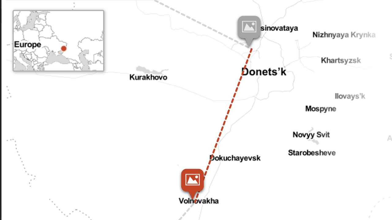
Leaflet - a JavaScript library for interactive maps
►https://leafletjs.com
Leaflet is the leading open-source JavaScript library for mobile-friendly interactive maps.
Scrollame
►https://github.com/russellgoldenberg/scrollama

Scrollama is a modern & lightweight JavaScript library for scrollytelling using IntersectionObserver in favor of scroll events.
Important Changes
Version 2.0.0+: .onContainerEnter and .onContainerExit have been deprecated in favor of CSS property position: sticky;. How to use position sticky.
Version 1.4.0+: you must manually add the IntersectionObserver polyfill for cross-browser support. See installation for details.
Jump to examples.
Why?
Scrollytelling can be complicated to implement and difficult to make performant. The goal of this library is to provide a simple interface for creating scroll-driven interactives. Scrollama is focused on performance by using IntersectionObserver to handle element position detection.
Export Google Maps Route to KML/GPX - Geographic Information Systems Stack Exchange
▻https://gis.stackexchange.com/questions/152571/export-google-maps-route-to-kml-gpx
Since Google pulled the plug on Google Maps Classic, I’m reluctantly moving to its Google Maps New application.
However, I didn’t find how to export a route to a GPX or KML file so it can be copied onto my smartphone.
Can it do this? If not, is there a third-party solution?

