The Three Mawangdui Maps: Early Chinese Cartography – SOCKS
▻http://socks-studio.com/2014/03/02/the-three-mawangdui-maps-early-chinese-cartography
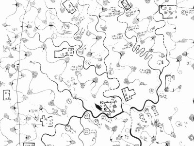
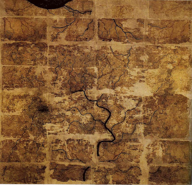
Between 1972 to 1974 three tombs in the archaeological site of Mawangdui, China, were excavated. In one of them, the archaeologists discovered three of the most ancients maps in China, contained in a lacquer box: a topographic, a military and a prefecture planimetry, oriented with south at the top. The maps, drawn on silk, display the Hunan, Guangdong and Guangxi regions and depict the political boundary between the Han and Nanyue Dynasty. The person buried in the tomb was probably a high-ranking official in the state; as his burial took place in 168 B.C. the maps must have been drawn earlier.
All three maps have been valued for their “modern” appearance: they use a planimetric projection, with the depiction tending towards conventionalization (of settlements, mountains and trees), and shows an early use of scale mapping. The scale varies between 1:150,000 and 1:200,000 in the central portion of the topographic map and between 1:80,00 and 1:100,000 in the central portion of the military map, a remarkably small scale error.
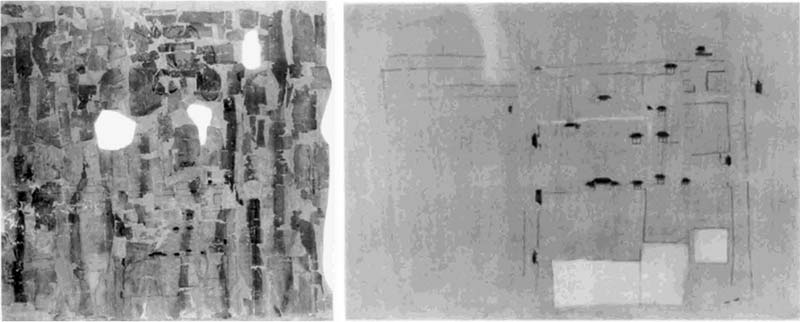
The prefecture map was in tatters when it was found and because of its conditions, its interpretation is difficult. Despite gaps, in the lower part it is still possible to recognize a city with an outer and inner wall.